
Trip from the most southern tip of mainland South America to the most northern tip of the mainland continent.
Using only unmotorized means of transport, such as:
running 368km, 40h |
walking 2783km, 642h
|
swimming <1km, <1h |
climbing 1km, 1h  |
pushing shopping cart 180km, 38h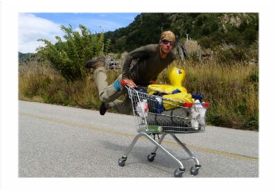
|
pushing wheelbarrow 222km, 39h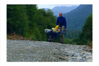 |
inflatable packraft 10km, 4h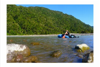 |
sea kayak 55km, 14h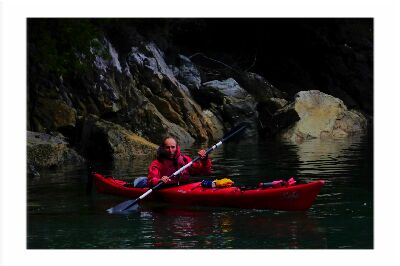
|
cycling 6558km, 407h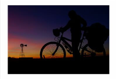 |
scooter 582km, 56h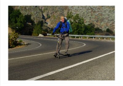 |
desert cart 1365km, 304h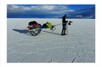
|
ice climbing 9km, 6h 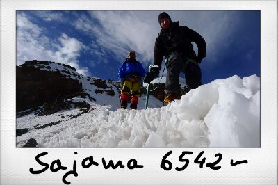
|
pedal boat 2km, 1h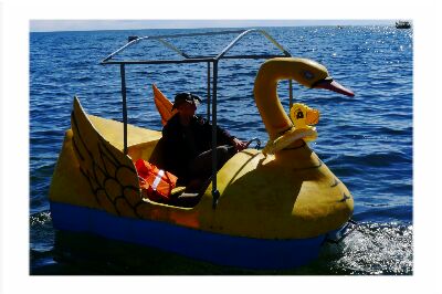 |
rowing boat 16km, 4h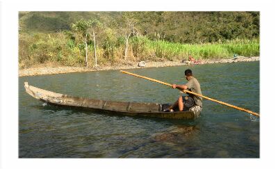
|
sailing boat 38km, 7h 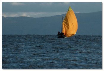
|
canoe 1065km, 171h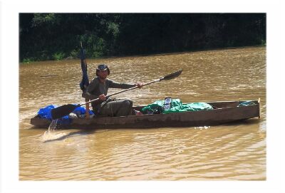 |
skateboarding 29km, 5h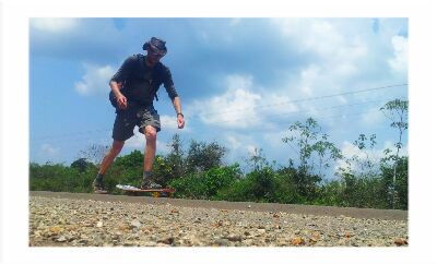 |
rollerskating 298km, 29h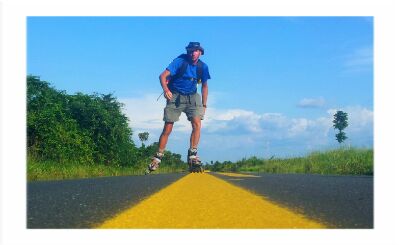 |
paragliding 7km, <1h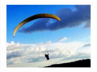 |
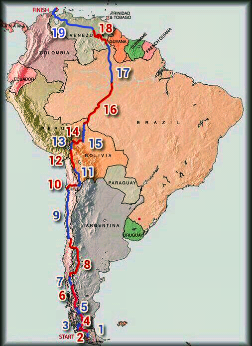
START: Cabo Froward, Chile, 20.01.2013
FINISH: Punta Gallinas, Colombia, 10.11.2013
ADVENTURE DURATION: |
295. days = 9.5 months |
|---|---|
KILOMETERS COVERED: |
13,588 km |
| stage | country | from - to | activity | days | days on/off |
km | avg. km/ day | max km/ day | weight kg |
1 |
Chile |
Cabo Froward - Punta Arenas |
running, walking, swimming, rock climbing |
5 |
4/1 |
136 |
27 |
44 |
70 |
2 |
Chile |
Punta Arenas - Puerto Natales |
running, walking |
9 |
7/2 |
271 |
30 |
47 |
69 |
3 |
Chile |
Puerto Natales - Cerro Castillo |
walking |
9 |
9/0 |
270 |
30 |
44 |
|
4 |
Argentina |
Cerro Castillo (Chile border) - Federica |
walking |
9 |
9/0 |
383 |
42 |
52 |
|
5 |
Argentina, Chile |
Federica - Chochrane |
walking, rock climbing |
13 |
12/1 |
404 |
31 |
45 |
63 |
6 |
Chile |
Chochrane - Chaiten |
walking, rock climbing, pushing and rides on shopping cart, pushing wheelbarrow |
22 |
21/1 |
761 |
34 |
60 |
66 |
7 |
Chile |
Chaiten - Cochamo |
pushing wheelbarrow, walking, vegetation climbing, river packraft, sea kayak, bicycle |
11.5 |
10.5/1 |
290 |
25 |
59 |
67 |
8 |
Chile, Argentina |
Cochamo - Santiago |
cycling, pushing bicycle |
21.5 |
19.5/2 |
1,594 |
74 |
146 |
69 |
9 |
Chile |
Santiago - Antofagasta |
scooter, bicycle, walking |
21 |
17/4 |
1,551 |
74 |
176 |
68 |
10 |
Chile |
Antofagasta - San Pedro de Atacama |
desert cart |
13 |
11/2 |
369 |
28 |
45 |
67 |
11 |
Chile, Bolivia |
San Pedro de Atacama - Sabaya |
desert cart |
26.5 |
23.5/3 |
612 |
23 |
35 |
|
12 |
Bolivia, Peru |
Sabaya - Copacabana |
desert cart |
17.5 |
14.5/3 |
471 |
27 |
43 |
61 |
13 |
Bolivia |
Copacabana - Pelechuco |
pedal, rowing and sail boat, walking |
9.5 |
7.5/2 |
225 |
23 |
45 |
|
14 |
Bolivia |
Pelechuco - Rurrenabaque |
walking, rowing boat |
20.5 |
18.5/2 |
370 |
18 |
45 |
63 |
15 |
Bolivia |
Rurrenabaque - Riberalta |
walking, cycling, canoe |
17 |
15/2 |
894 |
52 |
105 |
66 |
16 |
Bolivia, Brazil |
Riberalta - Manaus |
walking, skateboarding, rowing boat, cycling, canoe |
17 |
15/2 |
1401 |
82 |
148 |
|
17 |
Brazil, Venezuela |
Manaus - Santa Elena |
cycling, rollerskating, walking |
15 |
12/3 |
1074 |
71 |
137 |
67 |
18 |
Venezuela |
Santa Elena - Ciudad Bolivar |
cycling, walking, canoe, rowing boat, swimming |
25 |
22/3 |
1009 |
40 |
149 |
|
19 |
Venezuela, Colombia |
Ciudad Bolivar - Punta Gallinas |
cycling, walking |
13 |
13/0 |
1503 |
115 |
189 |
68 |
Total |
Cabo Froward - Punta Gallinas |
as above |
295 |
261/34 |
13,588 |
46 |
189 |
- 2 |
Country |
Days |
max. altitude |
Chile |
109 |
4,600 m |
Argentina |
28 |
2,553 m |
Bolivia |
90 |
6,542m |
Peru |
2 |
3,850m |
Brazil |
26 |
930m |
Venezuela |
35 |
1,391m |
Colombia |
4 |
70m |
Terrain |
Km |
Paved road |
7,854 |
4WD track |
1,679 |
Gravel road |
1,462 |
River |
1,085 |
Trail/path |
765 |
Cross country/trackless |
634 |
Sea |
55 |
Lake |
47 |
Air |
7 |
Nights |
No |
Tent |
163
|
Room |
114 |
Shed |
5 |
Abounded house |
5 |
Waiting room, big hall |
5 |
Bus stop |
3 |
Construction site |
3 |
Under the bridge |
2 |
School |
2 |
Hospital/Clinic |
2 |
Police |
2 |
Bus transformed into the house |
1 |
House ruin |
1 |
Military camp |
1 |
Excavator |
1 |
Timbers storage |
1 |
Mosquito net |
1 |
Very detailed info in excel format to be found here
![]()
Comparing the time and distance plan to the timereal performance in excel format to thebe found here
![]()
If you would like to share with me any helpful information (full list of enquires in the Adventure Plan),
give a hint, support mentally, or anything else, please contact me.
You can do it by leaving your comment below.
If you don’t have Facebook account, send me an email