Movie stage XVIII
| start date | activity | place | from - to | days | km | km/ day | comment |
| 11.11 | hike | Australian Alps Walking Track | Hotham - Cleve Cole Hut | 2 | 57 | 29 | |
| 13.11 | hike | Australian Alps Walking Track | climbing Mt Bogong | 1 | 8 | VIC highest summit | |
| 14.11 | hike | Australian Alps Walking Track | Cleve Cole Hut - Thredbo | 7 | 208 | 28 | wet almost every day |
| 21.11 | hike | Australian Alps Walking Track | Thredbo - Seaman's Hut | 1 | 16 | White out blizzard, NSW highest summit | |
| 22.11 | hike | Australian Alps Walking Track | Seaman's Hut - Mackay's Hut | 3 | 70 | 23 | hiking in company of others |
| 25.11 | hike | Australian Alps Walking Track | Mackay's Hut - Namadgi | 3.5 | 149 | 43 | ACT highest sunmit, fast solo hiking |
 The logistical challenge of arranging bicycle transport from Hotham to the capital turned out to be problematic, I could not find help for a long time. Finally the third Facebook community group resulted in positive effect. Stuart Tripp came to the hostel in Hotham, brought me a lot of delicious food, and finally took my bike to Canberra. It didn't go through my mind that Stuart went there just for me - 12 hours of driving not including breaks, over 800km on winding mountain roads! People are great, and Stuart himself is an interesting person - he lost a leg in an accident, then fell into the trap of smoking and drinking, but sport finally took him into a better path - he has already finished his career in hand cycling and even won a silver paralympic medal! He described his struggles in the book "Traveling Hopefully".
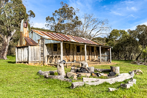
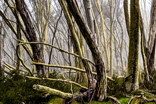
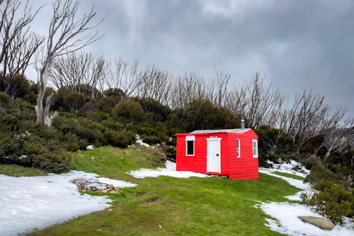
After a hearty breakfast with Stuart I set off on the Australian Alps Walking Track (AAWT). Unfortunately, there was a thick fog and there were no views, and the forecasted rains meant that I had to hurry to cross the rivers before they rose. The weather was getting worse and on the third day I got stuck in one hut built for the hikers. I spent two nights in Cleve Cole Hut strolling only to Mt Bogong 1986m, Victoria's highest peak. Despite the terrible weather on the third day I kept walking, streams turned into creeks, and creeks into rivers, I didn't know yet that I would have wet shoes for a week.
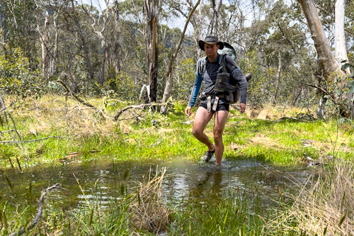 Navigation turned out to be an additional difficulty because many AAWT sections in Victoria were poorly marked or not marked at all, sometimes I had to bushbash for hours. I thought that in the valleys I would make up for lost time, but meanwhile the flat grounds turned out to be swamps. I often took off my boots and pants and went through huge puddles and streams looking for a shallower passage not to wet the backpack. Very slow (5 km in 3 hours) and mentally tiring. Added to this was the cold and snow, I was freezing, and one time in the tent I was shaking for all night.
If that wasn't enough, on the fifth day I lost sunglasses while bushbashing the forest and on the sixth one I reached the Morass Creek - I tried to cross it in three different places. However during the last attempt the river was up to my neck and only thanks to the strong bushes that I held on to the river did not swept me away. A bit scared I gave up the next attempts. Blood was pouring from my wounded legs, I was cold and I was looking for an alternative way - at the end of day I reached the other side of 50-meter river after a 19-kilometre detour, partly off-road. I had enough.
 I looked at the maps and fearfully analyzed the next rivers - will I cross them? I also thought that rangers closed the trail due to wet weather, as people said that every day I would meet other hikers, and I haven't met even one for a week. I was completely alone there with no information about what challenges might await me.
More and more often I encountered kangaroos and herds of wild horses. On the eighth day the sun finally came out and I met the first people. The off road bushbashing finished and Fire Trails began, which were much easier to navigate and my hiking pace increased. How I could to know the worst was yet to come?
 In Thredbo I went to a hostel where I was the only guest in the dormitory. The next day there was a lot of snow (60 cm) and the temperature in the higher parts was minus 8 degrees. The wind was blowing terribly, and the worst thing was that the weather forecast did not look better for at least the next three days. And I don't like to wait idly, so I decided on the biggest stupidity in this trip - in such terrible conditions I started climbing the mountains.
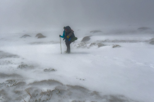
People were worried about me and Mal from the hostel got me a jumper, beanie and warm waterproof gloves. I was scared myself, so I asked my friend to watch my GPS tracking on computer, because if it stopped it would mean I was in trouble. At first I walked sheltered from the wind, within an hour and a half I was at the chair lift top station. However there was no soul there and the wind that hit me there blew away the rest of optimism from my head. Despite my doubts, I moved on.
I found a metal boardwalk and vertical long poles that marked the path. However it didn't last long when I found myself in a situation where the visibility fell below 50 meters - I couldn't see the boardwalk and the post in front and behind me. I waited. I was freezing. I was moving intuitively. Finally, a few seconds of thinning in the cloud and I saw the further pole - at the same time I saw that I was standing on an icy slope. It took a lot of stress to carefully reach the trail, then I thought I had to retreat because I didn't have a shovel to dig a snow cave and my tent wouldn't withstand a 120 km/h gale (feel like minus 20 degrees). I checked the GPS and I was closer to the top than to the wind-protected chair lift top station, so I pushed further as the return would be at the same difficulty.
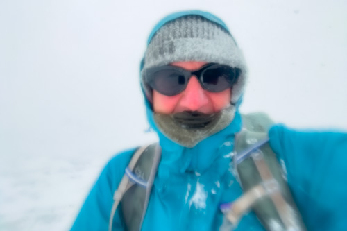 After reaching Rawson Pass I saw that Mount Kosciuszko (2228m) is 1700 meters away along the trail or 500 meters in a straight line. Since the path was under deep snow, of course I took a shortcut - it was so steep that I was on all fours limbs and I was sliding on the ice lying under half a meter of snow. But finally I reached the top of the highest mountain in mainland Australia (and the second in the country, after Mawson Peak 2744m on Heard Island). Although I was at the top for the fourth time, I had to capture it on video in such conditions. I took off my gloves and after a while my fingers went numb, my eyes watered, and ice crystals slapped my cheeks. Complete whiteout, I was running away from the top after a few minutes.
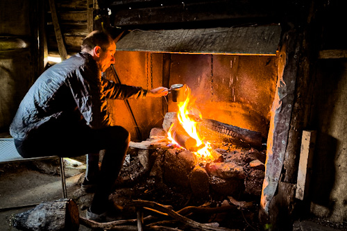
 I was hiking to Seaman's Hut - the highest building in Australia. The track was quite wide, the visibility was enough to see the next pole, snow up to my calves, sometimes up to my hips, but there were such powerful gusts of wind that I fell over a couple of times. I couldn't feel safe yet but I knew I was getting close to my goal. Oh, what a joy when I saw the shelter and what a surprise when I found a lonely woman inside. As it turned out, Ailsa was stuck there for a total of 4 days and didn't have the courage to go out in such weather. Unfortunately, she also couldn't make a fire, she was sitting there alone in the cold, so she was very happy to have my company. We chopped firewood and finally a nice warmth spread through the cabin, we both felt better.
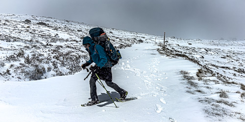 Ailsa shyly asked if she could come with me tomorrow. In the morning we set off - we lost our track at the start, I had to go back completely because the icy slope did not allow me to take a shortcut. The woman fell twice in the first five minutes and couldn't get up - it didn't look good. Fortunately this powerful gale was tail blowing, but unfortunately her backpack weighed over 30kg which slowed her down tremendously (she probably had everything there, she was prepared in case of a nuclear war). She tried and fought to progress but she was exhausted and I was freezing while waiting for her. Finally I offered her to swap backpacks - she took mine three/four times lighter, and I took her giant. I also took her snow shoes as not to collapse waist-deep with the weight, but at least our pace was a bit closer now. When we reached Charlotte Pass (6 km) after 3.5 hours of non-stop hiking, Ailsa burst into tears of emotion. I thought she was joking, but she was genuinely sobbing with relief that she was back among humans. And to be honest I was happy, finally during this trip I had an opportunity to do something for someone.
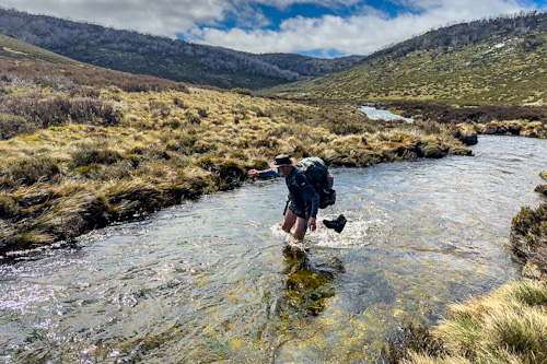
 After four days the snow stopped falling, the wind died down and the sun slowly came out. And that meant thaws and raised rivers. I usually slept in huts, and at the Horse Camp Hut I came across two other walkers. The next day we hiked together and they decided to end the day at 2pm. Too early for me so I continued on my way but didn't get far - Valentine Creek was too rough, deep and cold to cross. So I went back to Andrew and Keith, and the next morning we crossed the river together - it was only waist-deep, 30 cm shallower than previous afternoon, which made a big difference.
 Once solo I started walking like crazy - the last three days I made over 130km with nearly 3000 meters ascents, and in addition I was carrying food for 8 days because I thought I would walk much slower/longer. The food drop offs were not easy to find at all - I hung packages on trees 11 months earlier, and due to my mistake I lost the GPS waypoint coordinates and had to look for food in the forest. Once, however, I couldn't find it for an hour - I've walked around in circles and nothing. I finally found a video of me hanging the package a year ago,
and there was one frame where the house, road and tree could be seen in the distance - I walked around until I've finally seen the same perspective. I was in the right place but I did not find the package on the trees. It turned out, however, that the string broke and the food was on the ground - it survived untouched despite wild dogs, horses, rodents, as it was in strong plastic containers.
Once solo I started walking like crazy - the last three days I made over 130km with nearly 3000 meters ascents, and in addition I was carrying food for 8 days because I thought I would walk much slower/longer. The food drop offs were not easy to find at all - I hung packages on trees 11 months earlier, and due to my mistake I lost the GPS waypoint coordinates and had to look for food in the forest. Once, however, I couldn't find it for an hour - I've walked around in circles and nothing. I finally found a video of me hanging the package a year ago,
and there was one frame where the house, road and tree could be seen in the distance - I walked around until I've finally seen the same perspective. I was in the right place but I did not find the package on the trees. It turned out, however, that the string broke and the food was on the ground - it survived untouched despite wild dogs, horses, rodents, as it was in strong plastic containers.
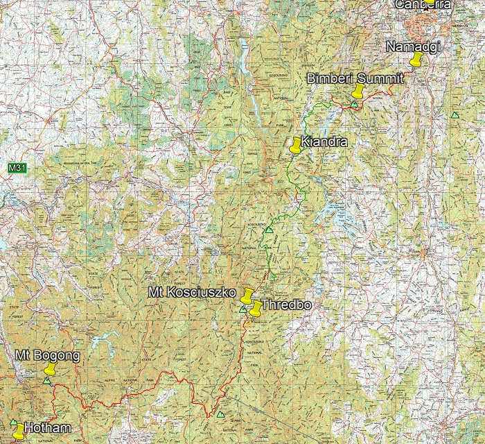
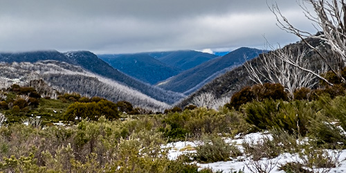 On the way I climbed the highest peak in the Australian Capital Territory, Bimberi 1913m. From there, it was just a quick trek to Canberra, completing 500km AAWT trails. It was not easy, but a very interesting experience.